Digital Groundwater for the Nile Basin
Strengthening basin capacity for groundwater management with digital services
- Location: Uganda, Burundi, Rwanda, Tanzania, Kenya, Ethiopia and Sudan
- Date: 2024
- Client: Nile Basin Initiative (NBI)
- Project Type: Digital services, Groundwater mapping
Digital and data services to improve water management
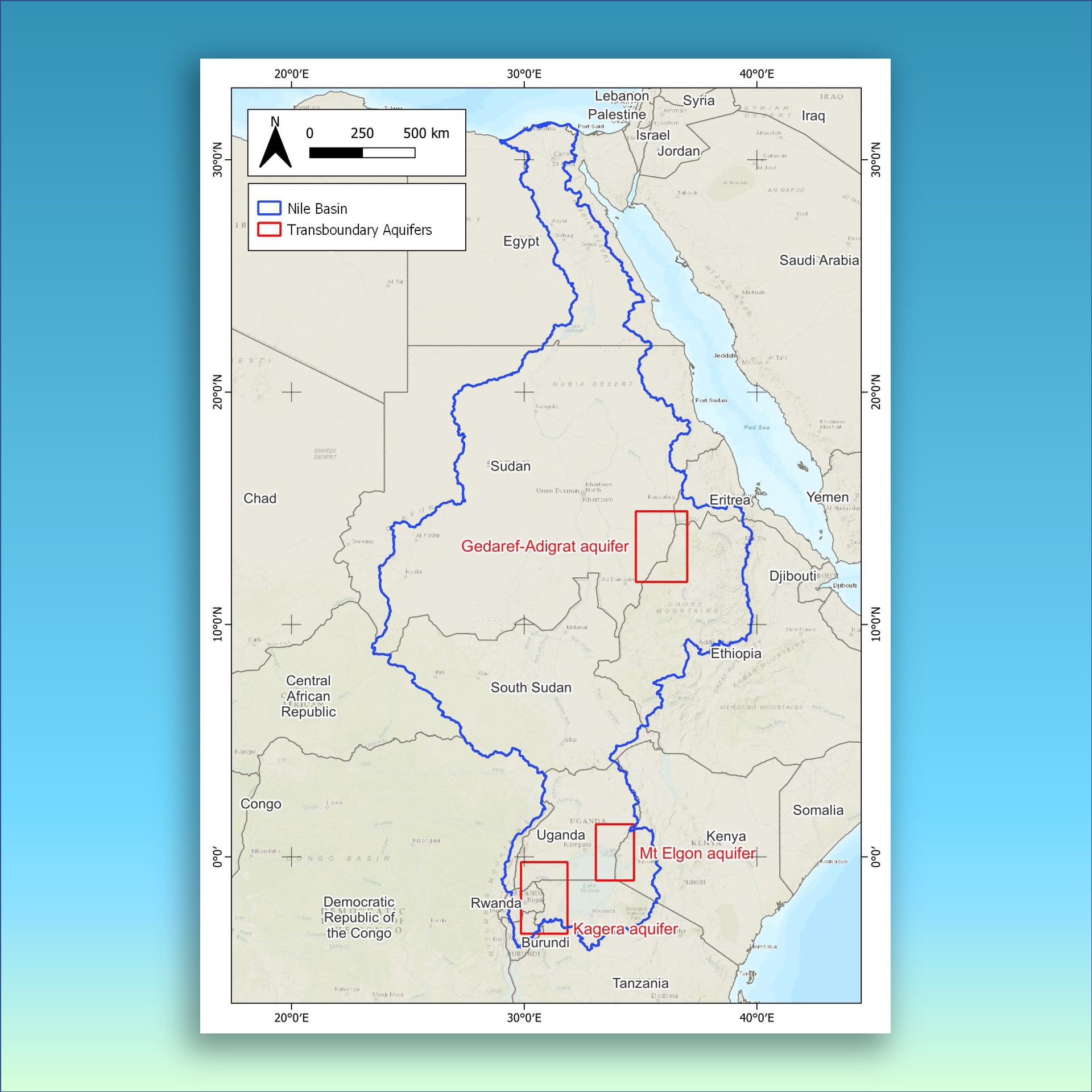
Countries sharing the water resources of the greater Nile River basin are working together to respond to climate change impacts and strengthen how water is managed across borders. The nations have come together under the Nile Basin Initiative (NBI) to enhance the shared understanding of groundwater in the basin region in an effort to improve how important aquifers are managed. In 2024, the NBI commissioned Hydro Nova to support the design and development of an online Groundwater Knowledge and Database Management System (GWDB) for three selected transboundary aquifers in the Nile basin.
Our digital services specialists are assisting the NBI by compiling and processing the international knowledgebase related to the Kagera Aquifer (Burundi, Rwanda, Tanzania and Uganda), Mt Elgon Aquifer (Kenya and Uganda) and the Gedaref-Adigrat Aquifer (Ethiopia and Sudan). Our team has developed a unique online tool that archives data into a useful database, a mapping system and database user interface to enable researchers and water managers of the Basin countries to share and manage the groundwater related information.
Services Provided
Data import and system design
Our team of hydrologists and data specialists collected, analyzed and processed data related to the three aquifers across seven countries, designing a basin-wide database that could store and map related to the aquifers, providing a critical inventory of information.
Online Groundwater Data Management System
For the NBI and Basin countries, we developed the Groundwater Knowledge and Database Management System, a tool that contains a database, a web-GIS mapping system, and shares aquifer-level data.
Integration and roll-out
Our specialists are integrating the tool with the Basin’s existing knowledge portal with access provided to users from the seven Basin countries. We’re training key stakeholders in using the tool in their home country.