Flood Risk Mapping and Protection Scheme for Kismayo and Garowe Cities (Somalia)
Building climate resilient cities with flood and stormwater management technology
- Location: Garowe and Kismayo, Somalia
- Date: 2021 – 2022
- Client: The World Bank Group
- Project Type: Urban flood risk mitigation
Improving flood and stormwater defenses with simulation and planning
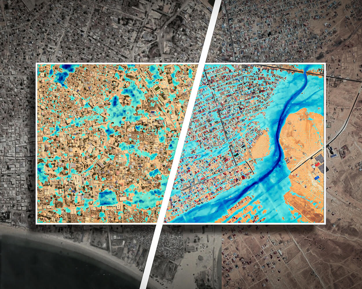
The growing cities of Kismayo and Garowe in Somalia have been subject to persistent stormwater drainage and urban flooding challenges, causing considerable damages to property and hindering urban development. The World Bank commissioned Hydro Nova to assess urban flood risk, develop integrated urban flood management and stormwater drainage solutions and identify priority flood risk mitigation investments for the two cities.
Our expert flood team used flood predictive modelling to map future flood and stormwater risk and determine best measures for long-term flood resilience. The project promises to help shield over 500,000 people and their property from devastating floods in the future.
Services Provided
Flood and stormwater prediction tool
Our team mapped the urban built-area footprint and existing drainage network of the two cities, building a two-dimensional hydraulic finite model to simulate future floods and stormwater drainage.
Risk assessment
Using our flood prediction tool, our team identified current and future hotspots of urban flood risk where infrastructure improvements could be targeted.
Flood and stormwater protection scheme
Our prediction and assessment of flood risk allowed us to test the feasibility of a range of infrastructure options and recommend the most suitable designs to protect communities from devastation from flooding.