Mapping Flooding Risk for Ravenna City – Italy
Flood risk identification mobilizing the power of digital modeling
- Location: Ravenna, Italy
- Date: 2003 – 2004
- Client: City of Ravenna
- Project Type: Flood risk reduction
Mapping for flood risk management
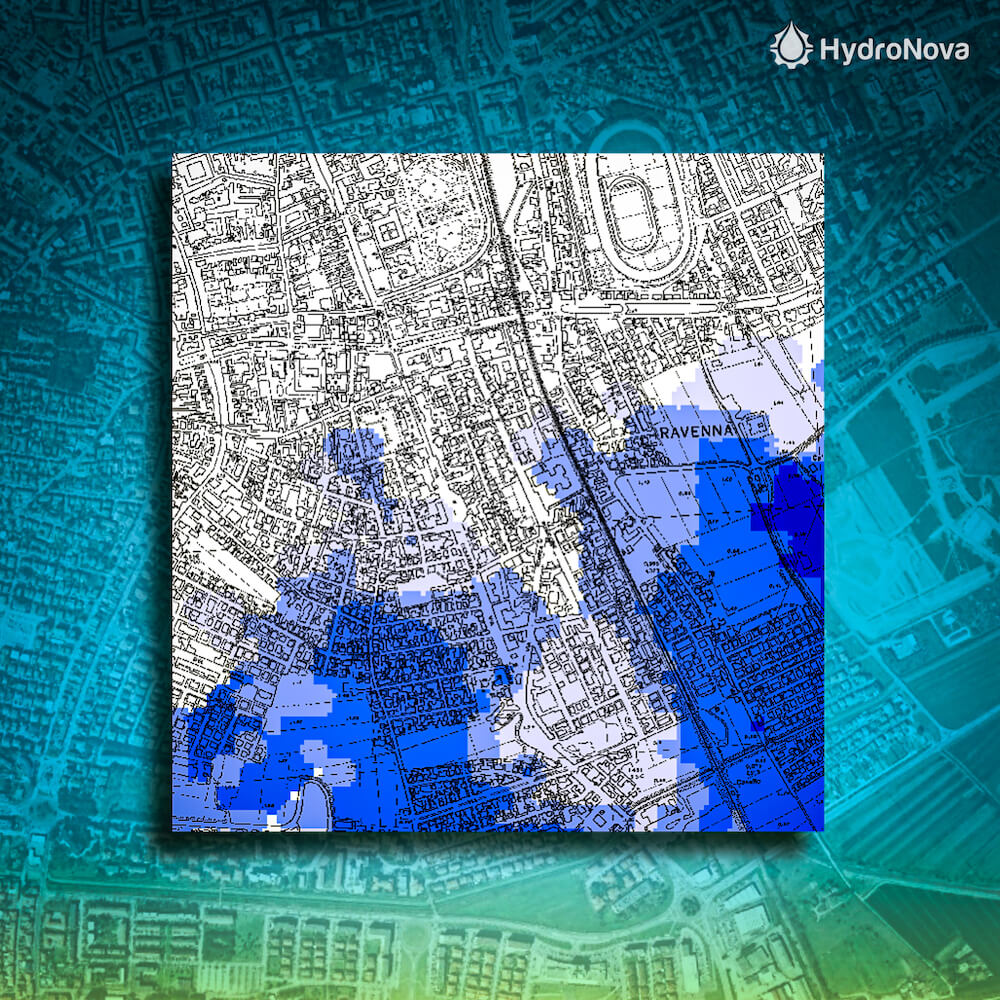
The City of Ravenna on the Adriatic Sea has been subject to rising sea level and land subsidence, increasing the risk of devastating floods. The City of Ravenna commissioned Hydro Nova to understand where risk for flooding was greatest so it could devise a plan to shield the ancient city from calamity.
Through our hydrological and hydrodynamic models, we developed a computer-aided flood disaster risk prediction tool. We then visualized flooding risk and evaluated flooding risk impact. The city has been independently using our analysis for flood disaster risk management.
Services Provided
Urban topographic analysis
We identified the flood-prone neighborhoods of Ravenna through a Digital Elevation Model. Our terrain analysis enabled us to measure the subsidence occurring.
Weather and climate analysis
We analyzed meteorological data to predict severity and likelihood of severe storms.
Hydrological and water resources analysis
We achieved a robust analysis of hydrology through hydraulic modeling of the Montone and Ronco rivers, drainage and canal network, and tidal effect.
Flood prediction modeling
Our team predicted where flooding would occur if levees were breached or if storm surge occur.
Flood risk analysis
Our analysis showed where hazards, vulnerability and risk are highest in the Ravenna City area.