Mapping Rwanda’s Groundwater
Enhancing water supply planning and project success
- Location: Southeastern region of Rwanda
- Date: 2022 – 2023
- Client: UNICEF
- Project Type: Groundwater mapping, water supply planning
Mapping and exploration services to expand water supplies in water-scarce Rwanda
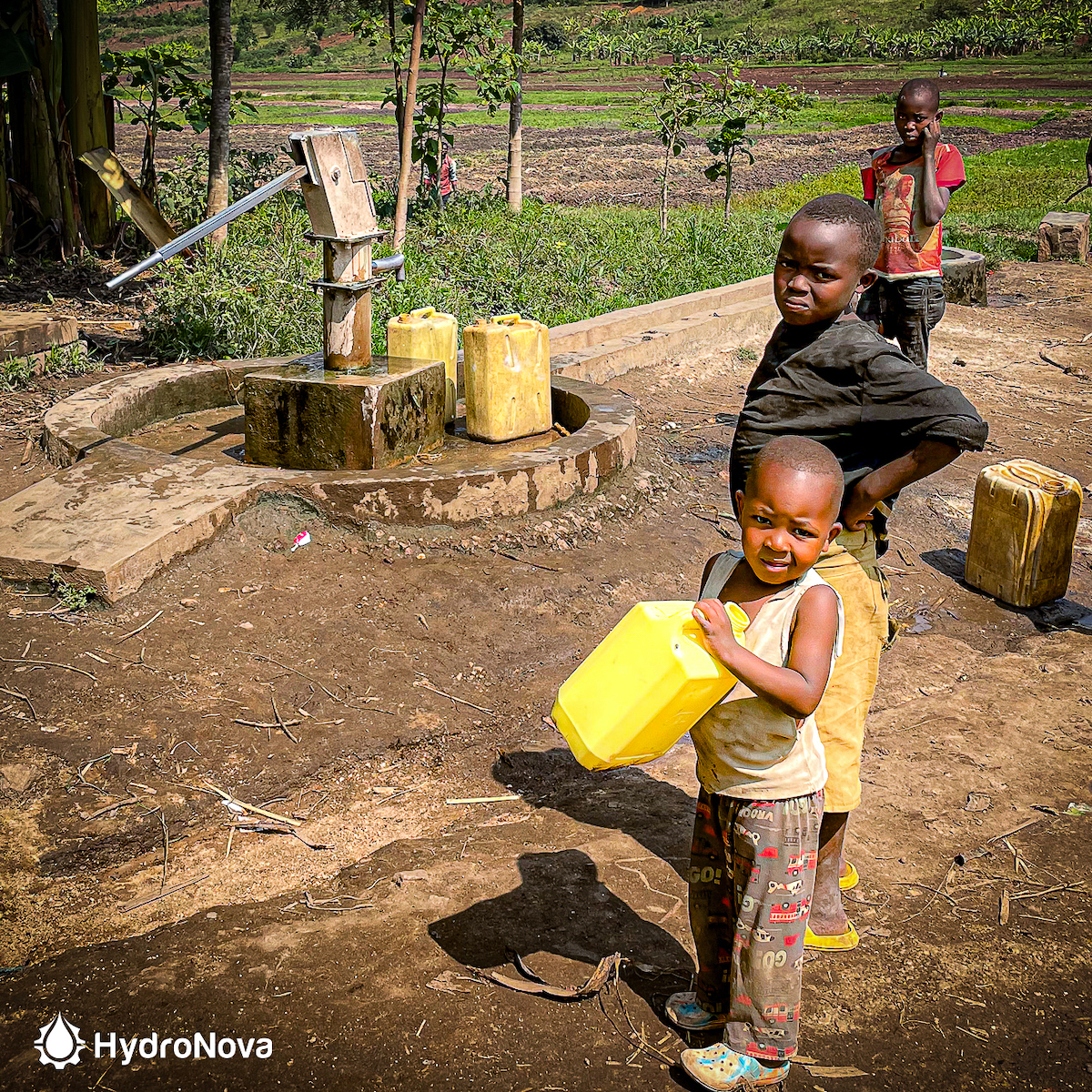
With the southeastern region facing persistent drought and water, the Rwanda government has sought to expand water supplies with groundwater to make it easier for people to get clean water. But many boreholes have failed or producing too little water, and planners haven’t had enough good information about how locate and design successful wells. UNICEF commissioned Hydro Nova to map the groundwater and find out more about how and where to set up new water supplies in the area.
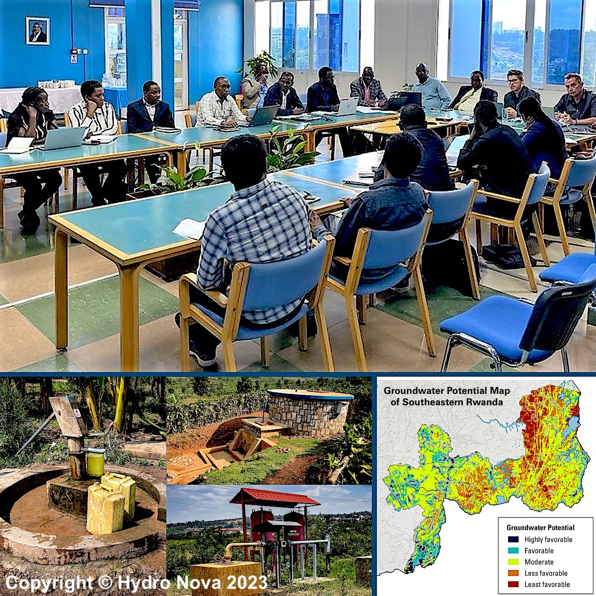
Our exploration specialists used satellite technology to scan the earth and simulate fractured bedrock geology, developing a regional suitability map of groundwater development. We identified 72 potential sites that could be developed into an additional water supply of 16,000 m3/day, enough to serve over 500,000 people. In addition, we found 126 areas across the region where government and water providers could focus their investment on building new water supply infrastructure. Our maps and intelligence have set the stage for improved water access in Rwanda by providing an actionable step-by-step roadmap for expanding the country’s groundwater supply.
Services Provided
Groundwater potential mapping
We developed a high-resolution regional map that predicts groundwater potential for decision making using cutting-edge satellite imagery processing and fractured bedrock simulation technology. The GWP map pinpoints prime areas for drilling boreholes and wells, conducting field surveys, and developing groundwater protection and monitoring plans.
New water supply well siting
Our exploration team conducted field surveys and investigations, resulting in the discovery of 126 zones for infrastructure development and 72 potential well sites ready for testing and drilling.
Groundwater data tool
We built a dynamic online database of maps and information that Rwandan agencies can use to improve groundwater supply operations and support management decision making.
Roadmap for developing water supplies
Hydro Nova created a ready-to-fund plan for infrastructure development in southeastern Rwanda. The roadmap guides planners in locating, sizing and budgeting new water well projects and provides blueprints for successful drilling, testing and delivery.
Exploration training
Our team taught Rwandan water experts how to find the best places for new water supply boreholes and how to plan them based on new groundwater intelligence and best practices.
Resources

Document: Report (23 MB pdf)
Mapping of Groundwater Potential in Southeastern Rwanda, UNICEF Report (2022)
Abstract
Reliable information describing the development potential of groundwater in the southeastern region of Rwanda is needed to resolve a variety of water resource issues including evaluation of target areas for groundwater development, prospecting for borehole sites, planning water supply systems, and monitoring. This report presents the method for estimating groundwater potential through multicriteria analysis and modeling, and presents maps of groundwater potential for the southeastern part of Rwanda to answer these needs.
The method of analysis used to determine groundwater potential in southeastern Rwanda relied on two types of readily available information: (1) raw satellite and processed data from remote sensing, and (2) ancillary data from official maps. Expert judgement also guided the development of key derived thematic layers and drove analysis, drawing from over 30 years of real-world successful application of the methods for groundwater exploration in similar hydrogeological settings.
Twelve thematic parameters related to the favorable conditions that make groundwater ‘available’ for development were developed, which form the building blocks of the groundwater potential model. Two component models—hydrogeologic favorability and recharge favorability – were combined for use in the indexation of the groundwater potential model.
The Groundwater Potential Map aims to make groundwater exploration in southeastern Rwanda as efficient as possible. The map is a first- level approximation of conditions favorable for a water supply system to be built and operated. It tells the hydrogeologist where to go to focus field exploration that will enable a new well or borehole to be sited. In the fractured bedrock setting of southeastern Rwanda, areas with favorable groundwater potential are those where constructing a productive, sustainable water supply well is most likely to succeed and carries lower risk. By contrast, areas with less favorable groundwater potential are those where conditions for installing a new well are less than optimal and pursuing development carries higher risk.
The results of the GWP model show variation across the study region, with notable differences between the western area (Kamonyi, Ruhango, Nyanza and Gisagara Districts) and the eastern area (Bugesera, Ngoma, Kirehe, Kayonza Districts). Overall, the study region has 18% favorable- to very- favorable GWP, with less favorable areas accounting for about 8%. The areas with the highest potential appear to correlate with low-lying drainage network areas, unsurprising for this more arid region.
Document: Report (23 MB pdf)

Document: Report (17 MB pdf)
A Roadmap for Scaling Up Sustainable Groundwater Supply in Rwanda
Abstract
Even with the use of compelling new maps and data, water supply boreholes may still be ineffective or constructed too far away from where consumers require water. The planning of boreholes must be improved in order to optimize water supply volumes and produce water over time. They must be placed in better locations, close to both a favorable groundwater potential and a target community that will use the water. The project’s experience has also highlighted the Rwanda water sector’s lack of a comprehensive approach to planning new groundwater development projects in order to achieve better, more sustainable, and more reliable results.
Therefore, this Roadmap has been prepared to provide a framework for planning groundwater development in Rwanda and to describe the steps that the water sector can take to achieve better results when installing a new borehole or well for water supply.
The Roadmap describes the most efficient and effective groundwater development approach and methodology tailored for Rwanda. The current UNICEF-supported project serves as a solid foundation for the approach, but the experience has also revealed areas where the project approach and methodology can be improved. The improved approach and methodology are described as a practical guidance document. Furthermore, the Roadmap recommends the activities that will be required in the future to create an enabling environment for improved groundwater development in Rwanda.
This report is a donation by Hydro Nova and We Consult to UNICEF and the Government of Rwanda. The contents of this report are the sole responsibility of the authors and do not necessarily reflect the views of UNICEF or the Government of Rwanda.
Document: Report (23 MB pdf)